Coastal Resilience Spotlight: Getting Ready for Rising Water with Westport
By Charlotte Dohrn

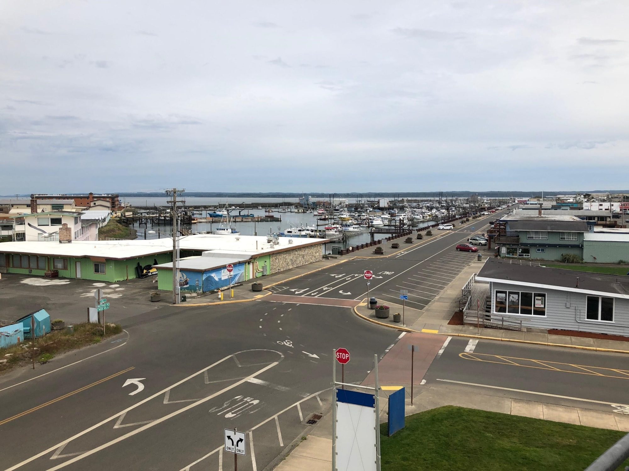
Perched at the end of a narrow, low-lying peninsula on the Washington coast, the city of Westport is no stranger to exposure. The sleepy fishing town gets about twice as much rain as Seattle, and in the winter it’s often pummeled by fierce gales, king tides, and swells that easily exceed 10 feet.
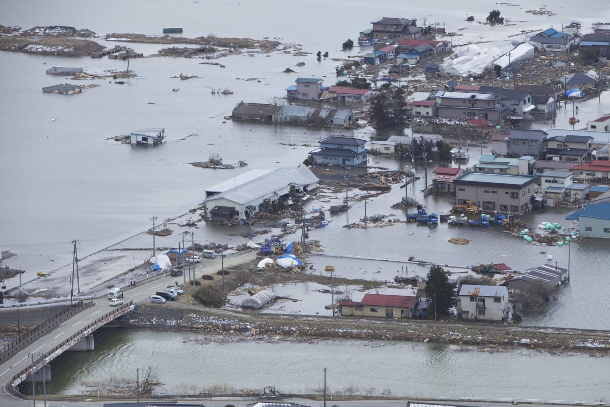
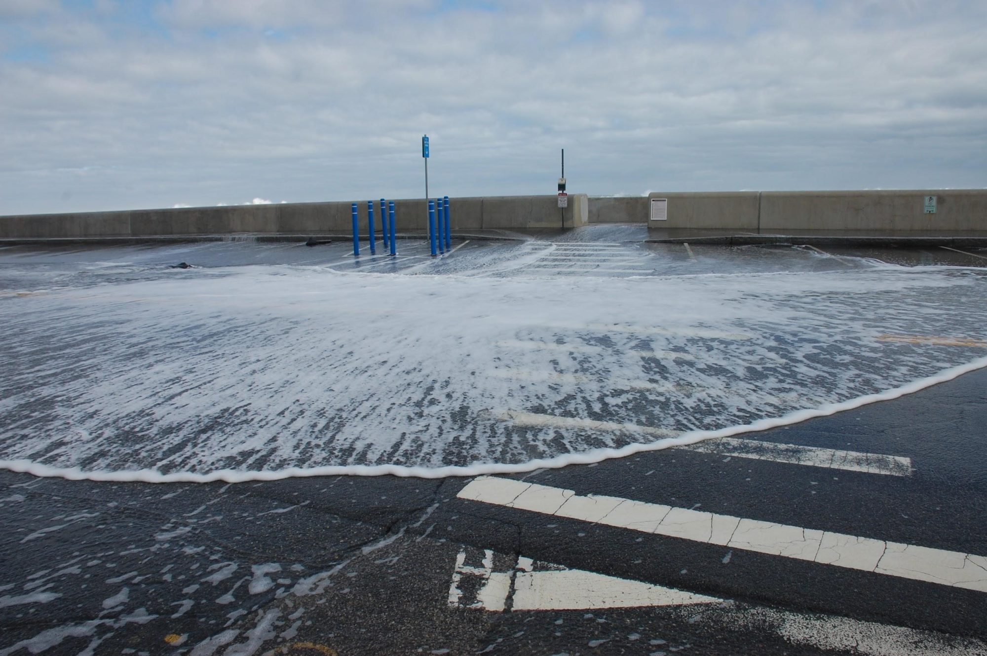
These routine coastal hazards pale in comparison to what Westport could experience when the next “big one” hits. The notorious Cascadia subduction zone has the potential to generate a magnitude 9 earthquake and a series of tsunami waves that could reach 40 to 50 feet, the first of which would reach Westport in about 20 minutes and continue for a period of many hours. In fact, it was just north of Westport on the Copalis River where scientists first learned about the destructive potential of a Cascadia event, discovering a ghost forest of drowned cedars. This discovery and additional tsunami-drowned cedar sites near Westport provided evidence of a massive earthquake and tsunami in 1700 that inundated the Washington coast and caused the land to drop several feet, killing coastal forests and depositing ocean sand far inland. While major earthquakes like this are rare and their prediction is uncertain, flooding caused by sea level rise is inevitable for Westport – like most coastal areas around the world. The latest projections from the Climate Impacts Group predict that Westport could see a foot of sea level rise by mid-century.
The recent IPCC Special Report on the impacts of 1.5°C of warming indicates that as many as 69 million people worldwide could be exposed to flooding from sea level rise by 2100, and over 130 major port cities could face flood impacts. With media coverage spelling out impending climate catastrophe, many of us have found ourselves asking: how do we prepare for a future that might be unrecognizable from the present? We have known for a long time that unchecked emissions are causing rising temperatures and rising seas, yet we lack examples of how communities can plan for uncertainty and adapt to change. Climate change preparedness has proven to be a difficult rallying cry at the national scale and in many communities. By preparing for the worst-case scenario – a catastrophic tsunami – Westport may be getting ahead of the game when it comes to adapting to future flooding.
Because of its precarious position, Westport residents are setting the national standard for hazard preparedness. Five years ago, the Ocosta School District passed a bond measure to build North America’s first ever vertical tsunami evacuation structure as part of a project to renovate the elementary school. From the outside, Ocosta Elementary looks like an average school – you can’t tell that it’s built on 169 pilings drilled 50 feet into the ground, or that the reinforced roof can hold 2,000 people about 50 feet off the ground – above the tsunami wave. At the time, the residents covered construction costs themselves through the bond measure. Thanks to their initiative and example, FEMA is now subsidizing the construction of vertical evacuation structures. Westport is currently applying for funding approval for a second vertical evacuation structure, and the nearby Shoalwater Bay Tribe has just received funding approval for construction of one on the Tokeland peninsula, 30-minutes’ drive to the south.
Building on the momentum from the vertical evacuation projects, Westport initiated a new project this year to plan and prepare for a future with higher water. In mid-November, an interdisciplinary group of UW students and researchers collaborated with Westport leaders to convene a community coastal resilience workshop. The workshop goal was to localize regional hazard mitigation and incorporate resilience strategies into comprehensive long-range planning for the City of Westport.
Over the course of two days, UW team members – including urban planning students and faculty, tsunami modelers, and earthquake geologists – sat down with Westport residents to learn about their vision of a resilient coastal community. Facilitators used an approach known as “appreciative inquiry,” where participants communicate shared values and then map the assets that provide these values. Participants then discuss how community assets can be leveraged or adapted to preserve and enhance values against vulnerabilities – such as losses from a devastating tsunami and associated land subsidence or end-of-century sea level rise.
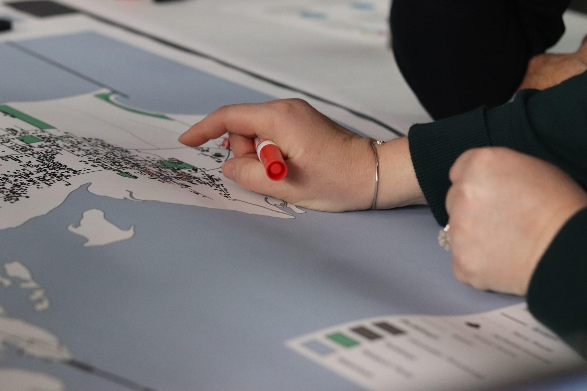
Through this approach, community members identify local priorities and robust strategies to adapt to a “new normal” with higher water under multiple scenarios. Collective visioning during the workshop generated ideas like developing a high-ground trail network, preemptively reinforcing bridges, establishing a ferry connection to nearby towns, retrofitting historic structures, re-establishing oyster beds as the coastline changes, and relocating critical facilities to the dune ridge that runs through town.
The UW team is currently compiling these ideas to provide recommendations for the City of Westport to inform an update of their Comprehensive Plan, which will lay the groundwork for creative solutions that increase hazard resilience and provide everyday benefits to residents. While tsunami-preparedness, climate adaptation, and community planning may seem like separate considerations, Westport’s integrative approach demonstrates how preparing for an uncertain future can increase coastal community resilience.
The UW studio class working on this project was supported by grants from the National Science Foundation, the Bullitt Foundation, and the Center for Safety and Equity in Transportation.